Pandemic Journal, Day 511

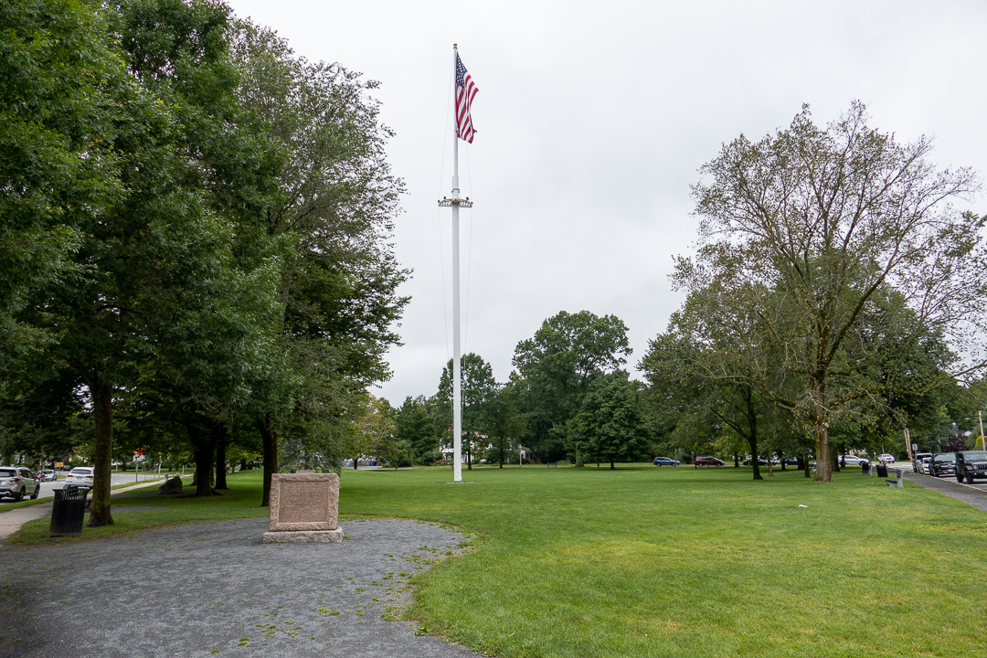
We went to Lexington today to learn more about how the American Revolution got started. Our first stop was the Lexington Battle Green – it didn’t look very impressive at first glance.

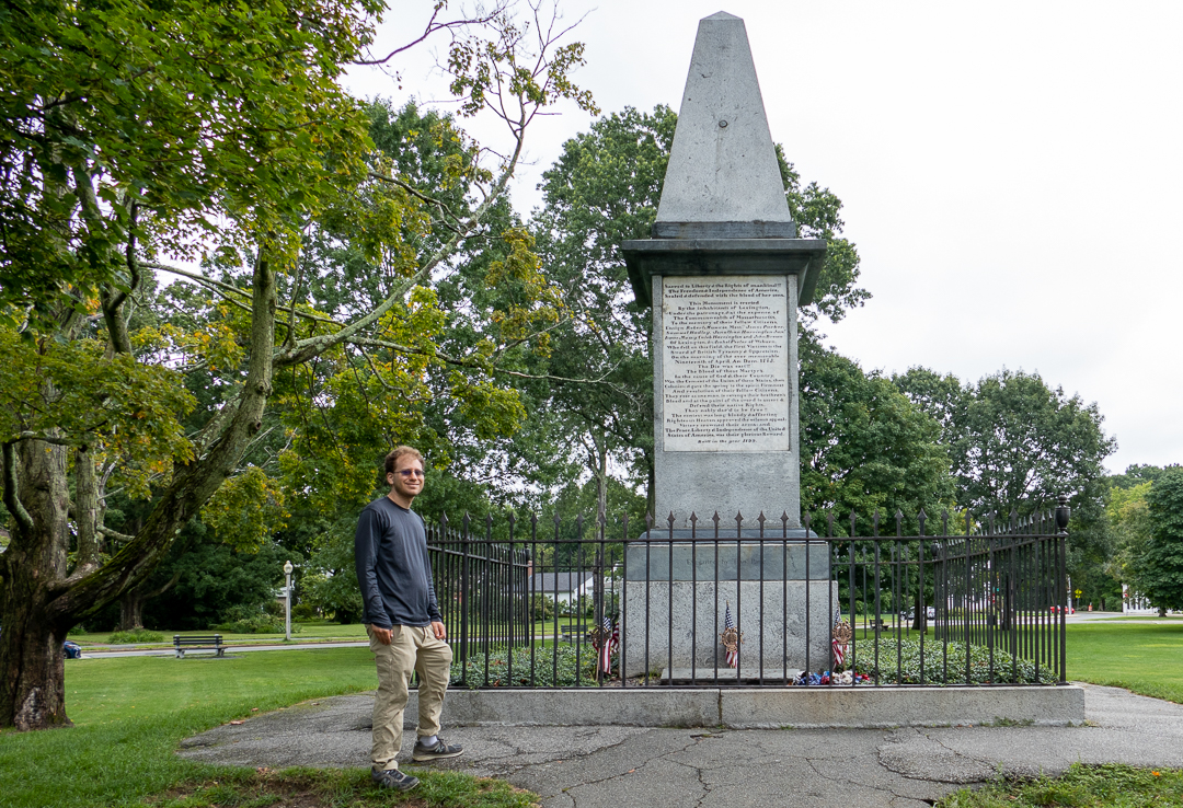
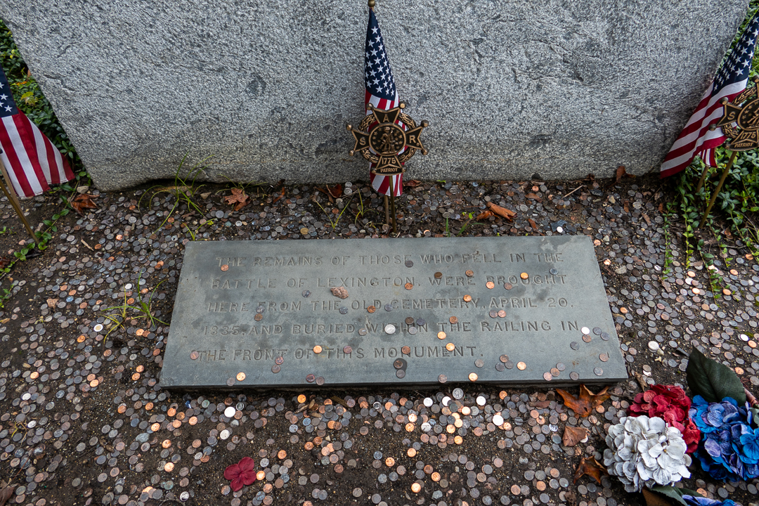
We took a walk around the Battle Green and saw a few interesting items, like the oldest Revolutionary War monument in the US, dating from 1799 (with the remains of the milita members who were killed at the Battle of Lexington reburied there).

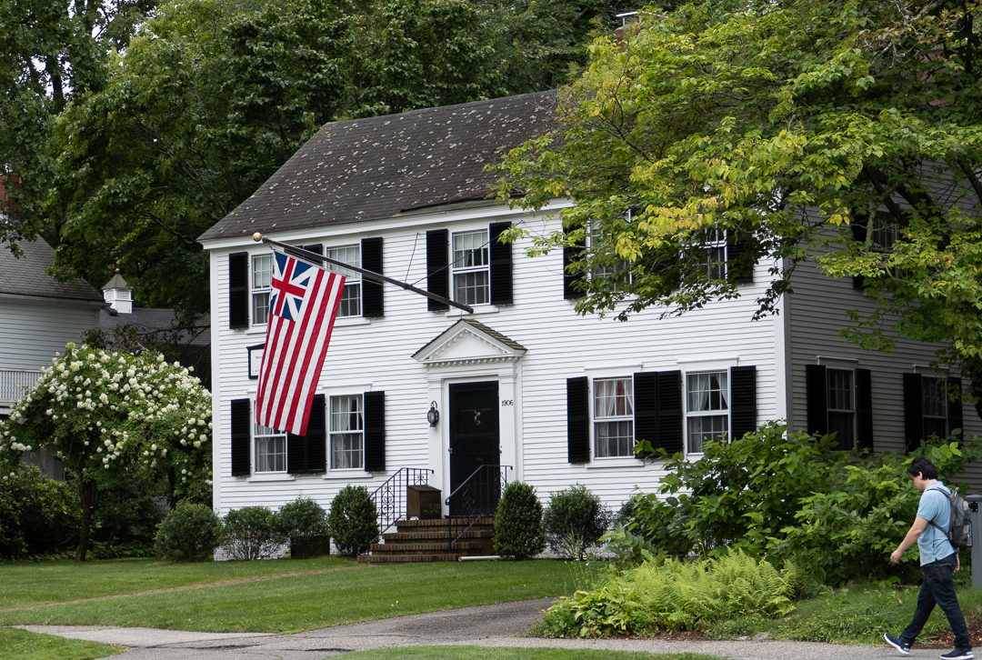
And across the street, we saw a huge house with an unfamiliar flag – Google told me that it was the Grand Union Flag, the first official US flag (and almost certainly the flag that George Washington flew when he sailed across the Delaware, not the one in the famous painting).

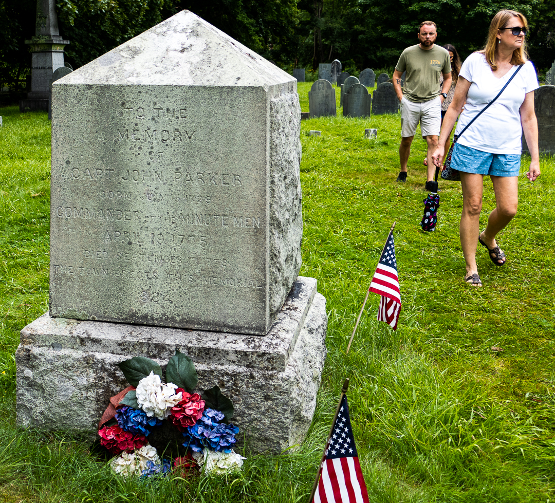
A few minutes later, we started our tour of the Battle Green – we looked at the Battle Green as a whole and found out how the British marched up Massachusetts Avenue from Boston and encountered the Americans who were there for a symbolic presence. Their commander, John Parker, ordered them to disperse and stand down – but in the darkness and confusion, when a shot suddenly rang out, the British regular troops started firing at the Americans, killing several. No one knows who fired that first shot – and it’s not for lack of investigations, beginning the very next day.

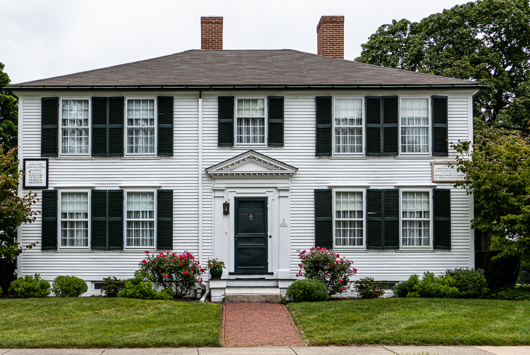
The house with the Grand Army flag was one of the few “witness” houses to survive to the present day; another one, the Harrington House, was owned by John Harrington, one of the Americans killed that day. He is supposed to have walked from the battle to the house (a distance of less than a block) and died on its doorstep.

We finished the tour at the Old Burying Ground, where John Parker is memorialized (and may be buried – nobody knows).

I recommend taking the tour if you are in the area. I also recommend having a car – we didn’t, so we walked the couple of miles up Mass Ave to our next stop, the Minute Man National Historic Park Visitor Center.

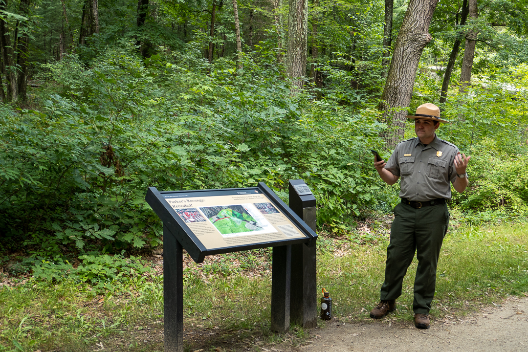
We arrived just in time to join a ranger-led walk to the site of “Parker’s Revenge”. After the British had marched up to Concord, only to find the arms they were supposed to seize had been moved, they had to go back to Boston – and there was only one road. Parker brought his troops up from Lexington and set them up as snipers – they harassed the British soldiers and shot several of them. The National Park Service carried out an archeological expedition to find out exactly where the battle happened – it’s an interesting story all by itself.

We had hoped to go to Concord, but it was almost five o’clock and we were tired, so we called a Lyft to take us back to Boston. It was a much easier journey than the British soldiers had taken in 1775. And we didn’t get rained on at all today!

Pandemic Journal, Day 510

Our streak of surprisingly good weather continued today in Boston, with a high of 76°F, and just a tiny bit of rain, enough to cool things down when we needed it.

Our son came to our hotel this morning about 10, and it was wonderful to see him after so long. We went out to his place in Allston to see where he lives (and of course to take advantage of the free laundry facilities)! We had lunch at Punjabi Palace – after 10 days in Iceland, it was a nice change!

This afternoon, we walked from Copely Square to the New England Aquarium by way of Phin Coffee House (yes, there are alternatives to Dunkin here). We’re taking a Brutalism tour with Boston By Foot – we’ve been on many of their tours in the past, mostly concentrating on all of the history that’s happened here, so this one should be different.

We looked at seven Brutalist buildings, all dating from the 1960s and 1970s – Brutalism fell out of favor quickly (partially because the cost of concrete increased!). The first was the New England Aquarium itself, which was built as part of a new mayor’s attempt to revive the waterfront and opened in 1969. Our guide told us that the best way to see the building as it was would be to see it from the water, but the photo below shows the Brutalist bones of the building, as well as the additions in 1996 and 2004, which are far more modern-looking.

After that, we looked at the two Harbor Towers apartment buildings. They’re about 40 stories tall and were built as affordable housing, opening in 1971. They faced the Central Artery highway (moved underground in the Big Dig) which separated them from the rest of Boston. They’ve been converted to condos and are now desirable housing!

Harbor Garage was the last building we looked at by the waterfront; its current owner wants to build a 600-foot-high tower over half the garage and promises to remove the other half to provide a “blue way” to the water to complement the Rose Kennedy Greenway which replaced the Central Artery. This is a controversial proposal, needless to say.

Our next stop was the State Street Bank Building (225 Franklin), built in 1966 – it was the first privately-developed major building in Boston’s Financial District in decades. The cantilevered openings along the sidewalk opened the building up to its surroundings, unlike Prudential Center and the John Hancock Building, which were built around the same time. This was my favorite building of the tour.

Walgreens currently occupies a 1972 addition to the Boston Five Cents Savings Bank building – when it was built, it was right on a street which has since been removed, giving it some breathing space.

The final building on the tour was Boston City Hall, which is the anchor of Government Center. It got mixed reviews when it was built, and still gets them today; the design is interesting since it puts the places where the public interacts with city government on the ground floor, ceremonial space on the next floor, and consigns the actual workers to the top floors.

By the time the tour ended, so had our stretch of good weather. There was a not-so-light drizzle when we got on the T to return to the Westin and by the time we got off, it was pouring. I wish I could bring some of the rain home with us!